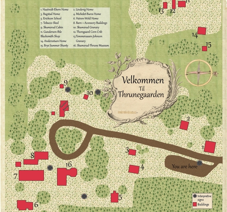
This is a map I created for the Norskedalen's Thrunegaarden main interpretive sign. The map shows the buildings and other sign placements for visitors to follow and learn more. For the map, I used textures and elements from enlightenment period maps to make it better fit the time period of the area. Due to its massive file size, the best I can place on here is a screenshot.